Pre 4.1 Height
48 files
-
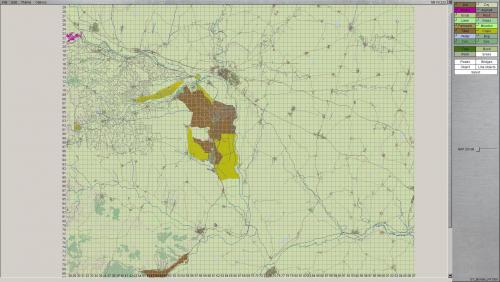
Suwalki Gap Height maps (2x)
By DarkAngel
Two (optional) heightmaps for the Suwalki gap. One is from SRTM30 the other is JAXA (ALOS)
Looking at the data the JAXA / ALOS version seems the best. I haven't checked in SB as to how noisy the data is.
130 downloads
(0 reviews)0 comments
Submitted
-
gulf war Iraq Kuwait NW Border (94x94km)
Iraq Kuwait NW Border (94x94km)
Includes the locations of the Battle of 73 Easting, Medina Ridge, and the sectors of 2ACR and 1st Infantry Division (Mech) in the south, 3d Armored Division in the center until 1st Armored Division's sector up north.
Special thanks to Gibson who helped me with the project.
196 downloads
- desert storm
- 1991
- (and 6 more)
(0 reviews)0 comments
Updated
-
BATUS Height file
By 12Alfa
To be used with BATUS Map V4.23
Located in Southeast Alberta, approximately 50 kilometres west of Medicine Hat, CFB Suffield has been the site of military training in the region since 1972. CFB Suffield is host to the largest military training area in Canada, conducting the largest live-fire training exercises in the country. The Manoeuvre Training Area covers 1,588 square kilometres of a 2,700 square kilometre base
Home of the British Training Unit in Canada
101 downloads
(0 reviews)0 comments
Updated
-
Golan Revised Alternative hgt
By DarkAngel
This is an alternative (test) heightmap using the 30m Jaxa data. To use it Back up any existing Golan revised height map and then rename this hgt to Golan_Revised.Hgt
94 downloads
(1 review)0 comments
Submitted
-
Golan heights revised 30m
By DarkAngel
Another version of the Golan Heights revised Height map. This is made from srtm 30m data re-sampled at 12m
156 downloads
(0 reviews)0 comments
Submitted
-
Greek Turkish Border (North) Height map
By DarkAngel
Height map for the Greek Turkish Border (North) as requested by Iskios. Map is created from 30m SRTM data sampled at 10m.
144 downloads
(0 reviews)0 comments
Submitted
-
Mingachevir Height map
By DarkAngel
Mingachevir Height map as requested by CharlieB. Map is created from 30m SRTM data sampled at 10m.
135 downloads
(0 reviews)0 comments
Submitted
-
Fulda gap (Alt) 2 Height maps
By DarkAngel
Height map for the Alternative Fulda Gap terrain map.
There are 2 versions of the heightmap one is derived from 90m SRTM sampled at 30m the other is 30m SRTM sampled at 30M.
238 downloads
(0 reviews)0 comments
Submitted
-
Gotland Height
By DarkAngel
Gotland Map as requested by KT (among others). Map is created from 2m Lidar data re-sampled to 10m. It does need some cleanup around the coast.235 downloads
(1 review)0 comments
Submitted
-
Greek/Turkish Border Height
By DarkAngel
Greek Turkish border as requested by Isikios. Created from SRTM data re-sampled at 30m218 downloads
(1 review)0 comments
Updated
-
Klietz Area Height
By DarkAngel
Klietz area as requested by Eisen. SRTM data imported at 30M.213 downloads
(1 review)0 comments
Submitted
-
Palava, Cz Height Map
By DarkAngel
Height map of the Palava region of Cz as requested by JustSomeGuy.
Map is created from SRTM data Re-sampled to 30M256 downloads
(1 review)0 comments
Submitted
-
Wagon Mound, New Mexico USA
By ashdivay
SW Corner Long 105° 2'36.84"W Lat 35°50'44.73"N
Wagon Mound, New Mexico USA148 downloads
(0 reviews)0 comments
Submitted
-
(0 reviews)
0 comments
Submitted
-
Ljubljana Gap Heightmap
By DarkAngel
Ljubljana Gap as requested by AlesMrak (Dr Jones) This is an 80x80km map derived at 30m from SRTM 90m data.266 downloads
(0 reviews)0 comments
Submitted
-
Revised Golan Heights Height map
By DarkAngel
A revision to the original Golan Heights map. This is a larger area and is shifted slightly west to center more on the heights.229 downloads
(1 review)0 comments
Submitted
-
Mondovi, WI area - Updated "hmap.hgt"
By Rotareneg
This is an updated version of the old hmap.raw/hgt height map with proper vertical scale and N-S orientation (no longer flipped N-S.)197 downloads
(1 review)0 comments
Submitted
-
Tskhinvali Georgia Heightmap2
By DarkAngel
Tskhinvali Heightmap altered. This is the base map from srtm with the height reduced by half and added noise.292 downloads
(0 reviews)0 comments
Submitted
-
Tskhinvali Georgia Heightmap1
By DarkAngel
Basic Heightmap derived from 90m SRTM data re-sampled at 30m249 downloads
(0 reviews)0 comments
Submitted
-
(0 reviews)
0 comments
Submitted
-
NGP_Bergedorf
By DarkAngel
60 x 40km heightmap for the NGP_Bergedorf terrain. Derived from SRTM 90m data re-sampled to 30m.365 downloads
(0 reviews)0 comments
Submitted
-
(1 review)
0 comments
Updated
-
TrübPlats_Münsingen
By Nachtfalke
This hgt is from Warulf and is required for map Trainig Area Münsingen292 downloads
(6 reviews)0 comments
Updated
-
Chase county, Kansas height map
By Rotareneg
Height map of most of Chase county, Kansas, from 2 meter LiDAR elevation data.309 downloads
(0 reviews)0 comments
Submitted
-
(0 reviews)
0 comments
Submitted


